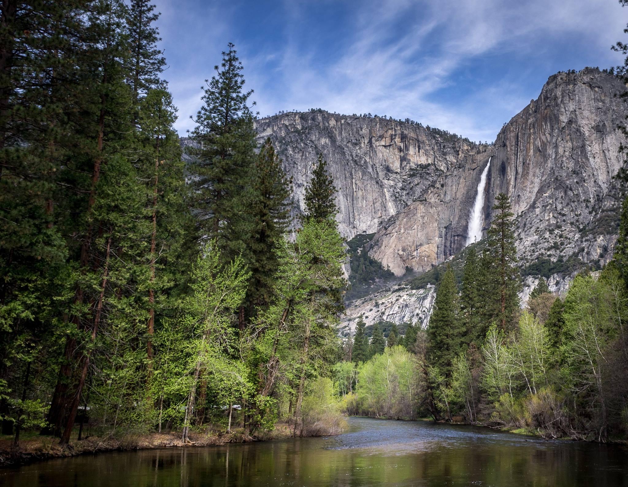
Upper Yosemite Fall and Merced River in spring
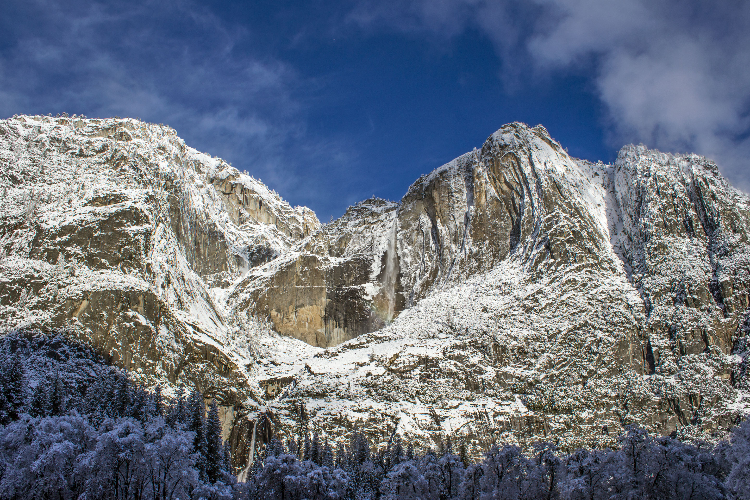
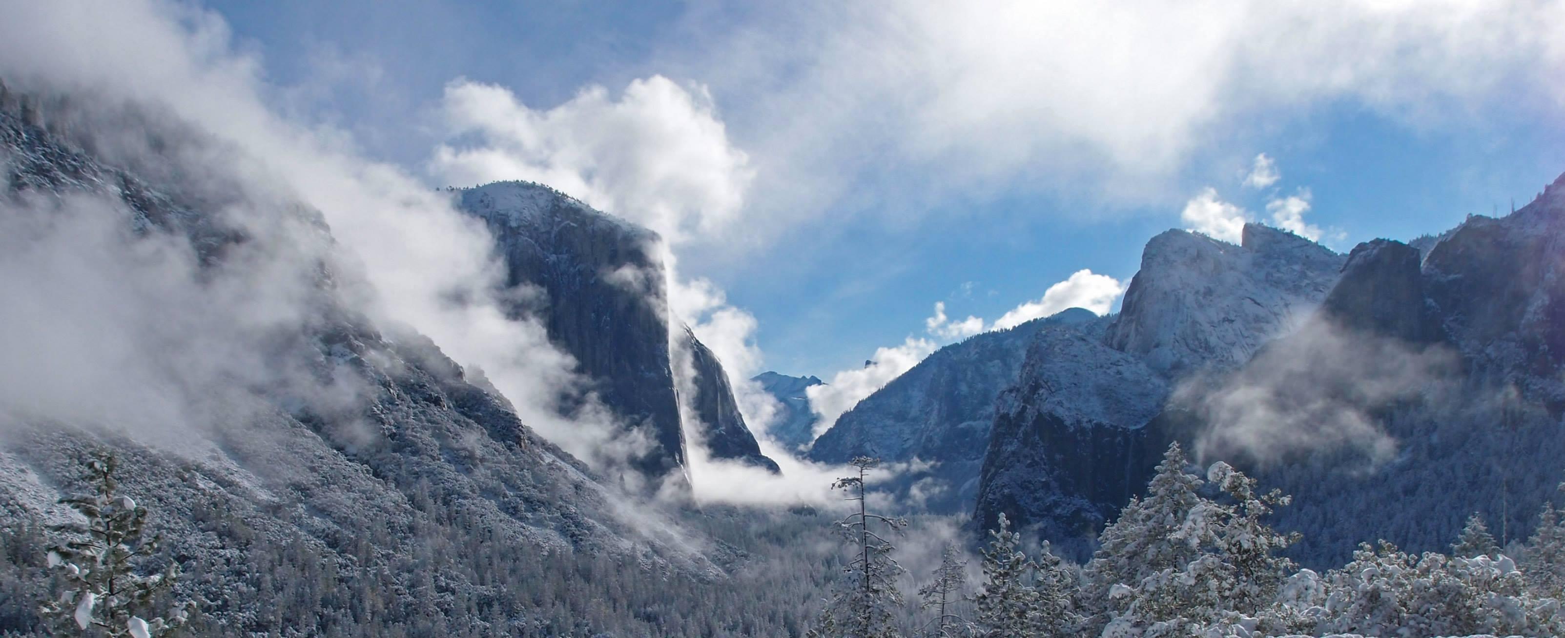
Yosemite Falls on a Winter Morning
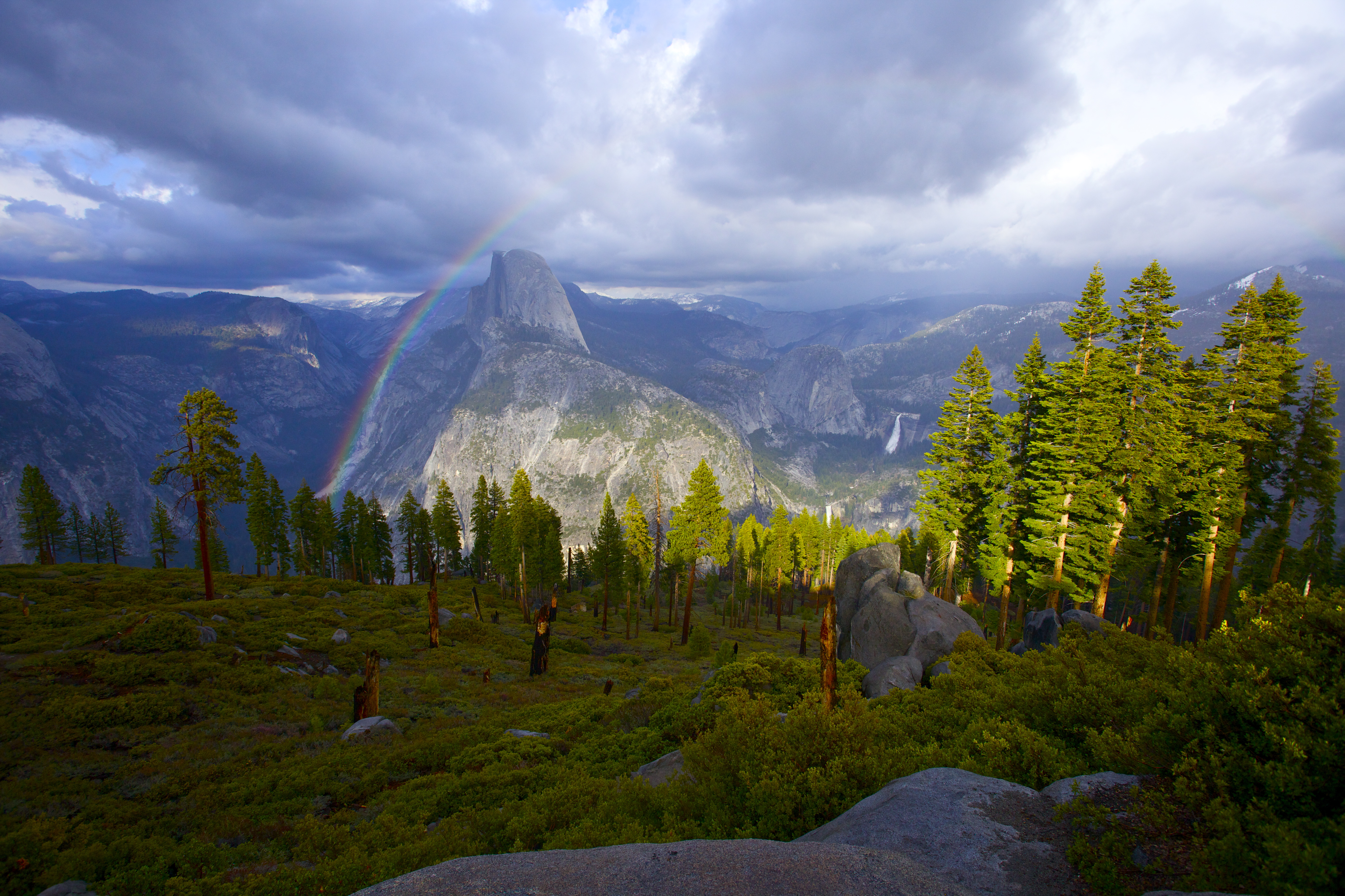
Rainbow over Half Dome
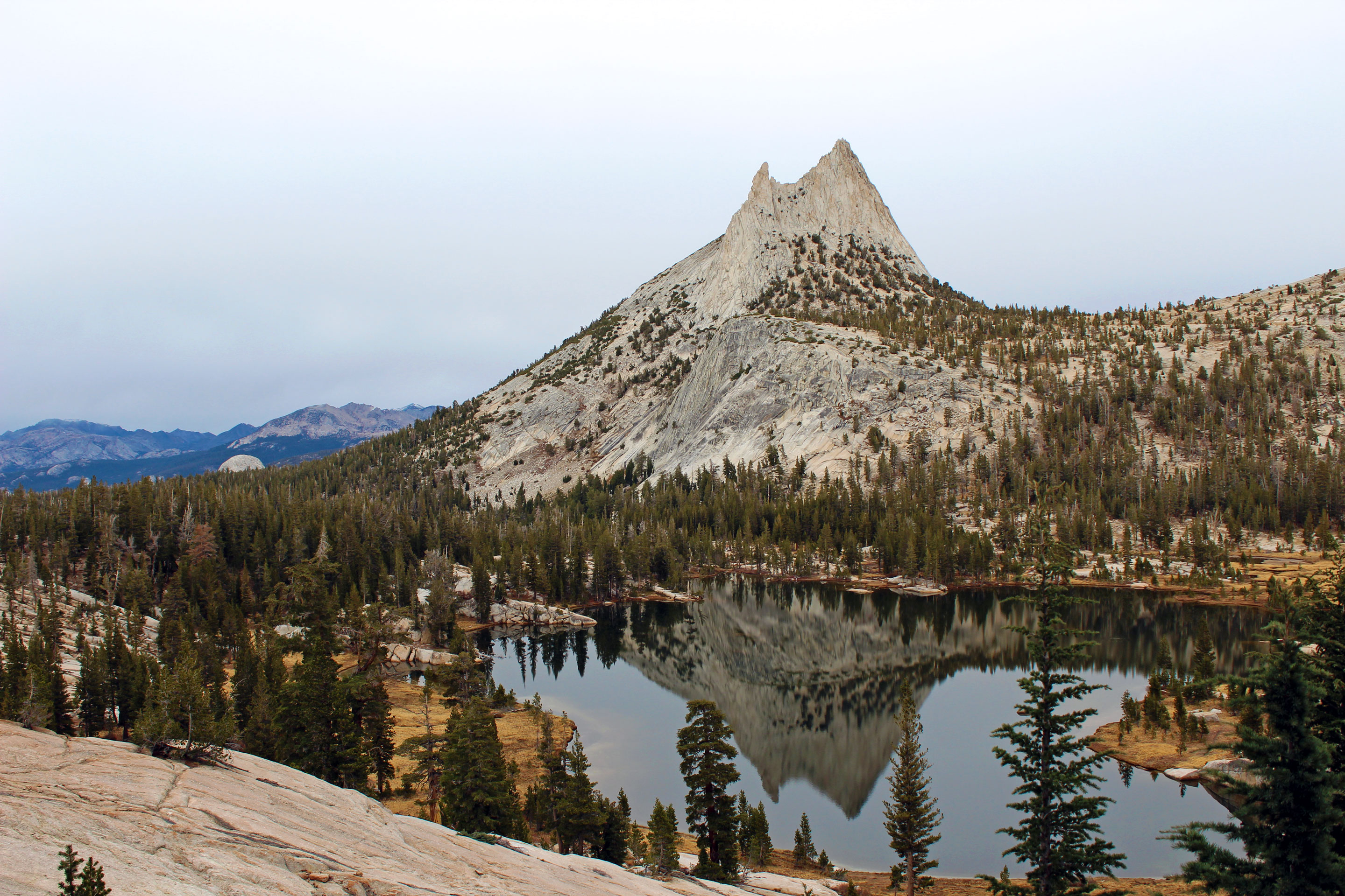
Cathedral Peak and Lake in Autumn
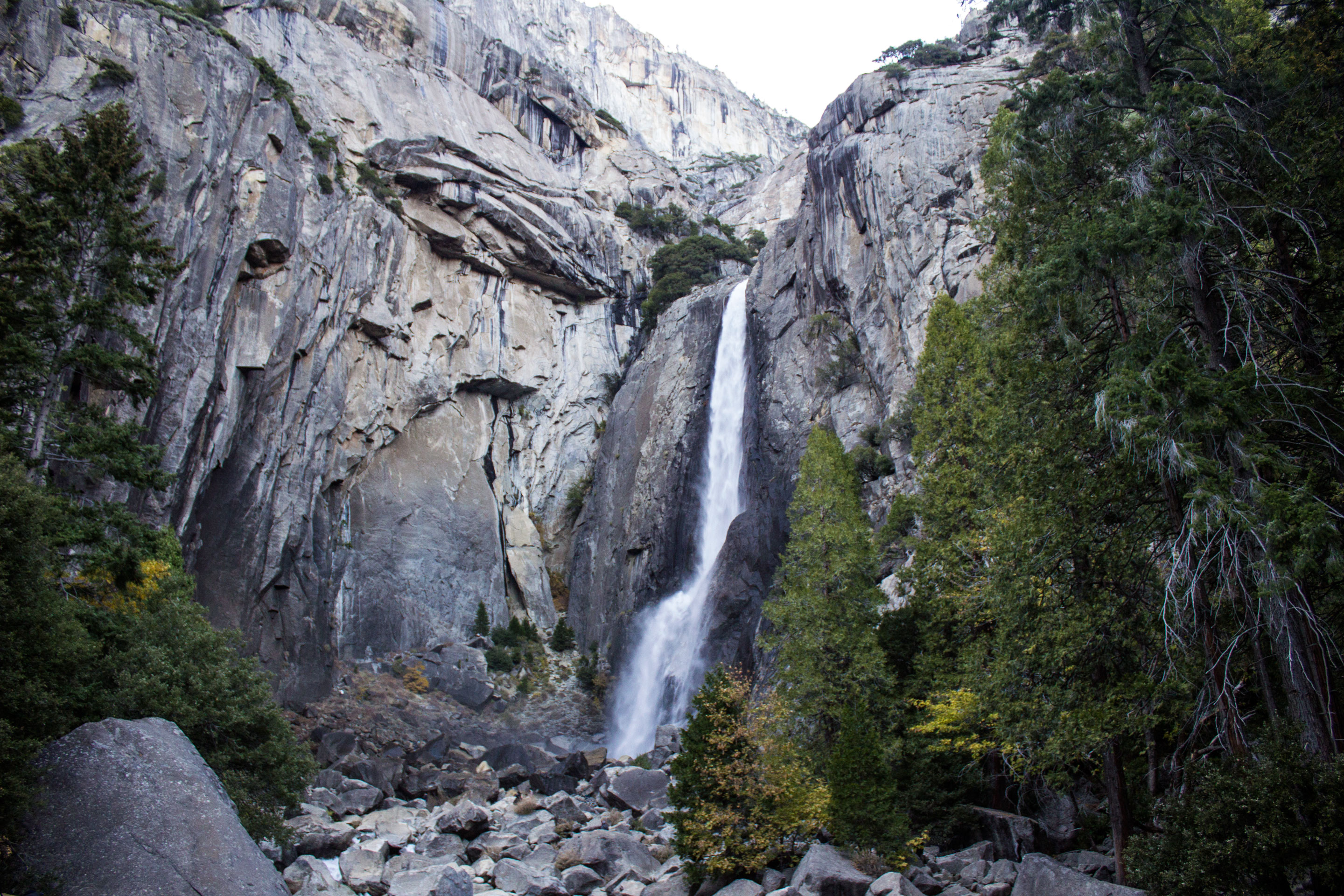
Lower Yosemite Fall
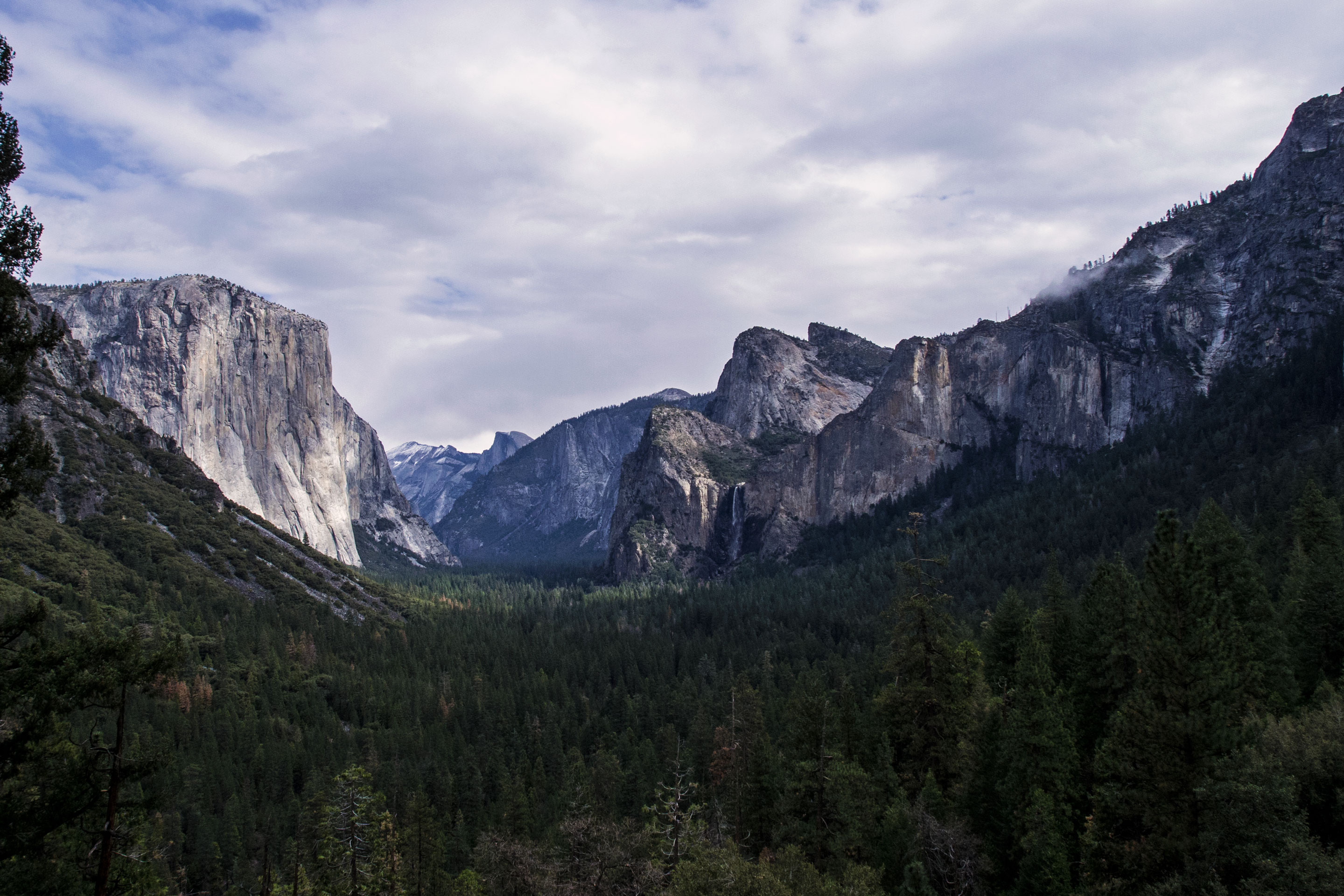
Yosemite Valley from Tunnel View
Glen Aulin
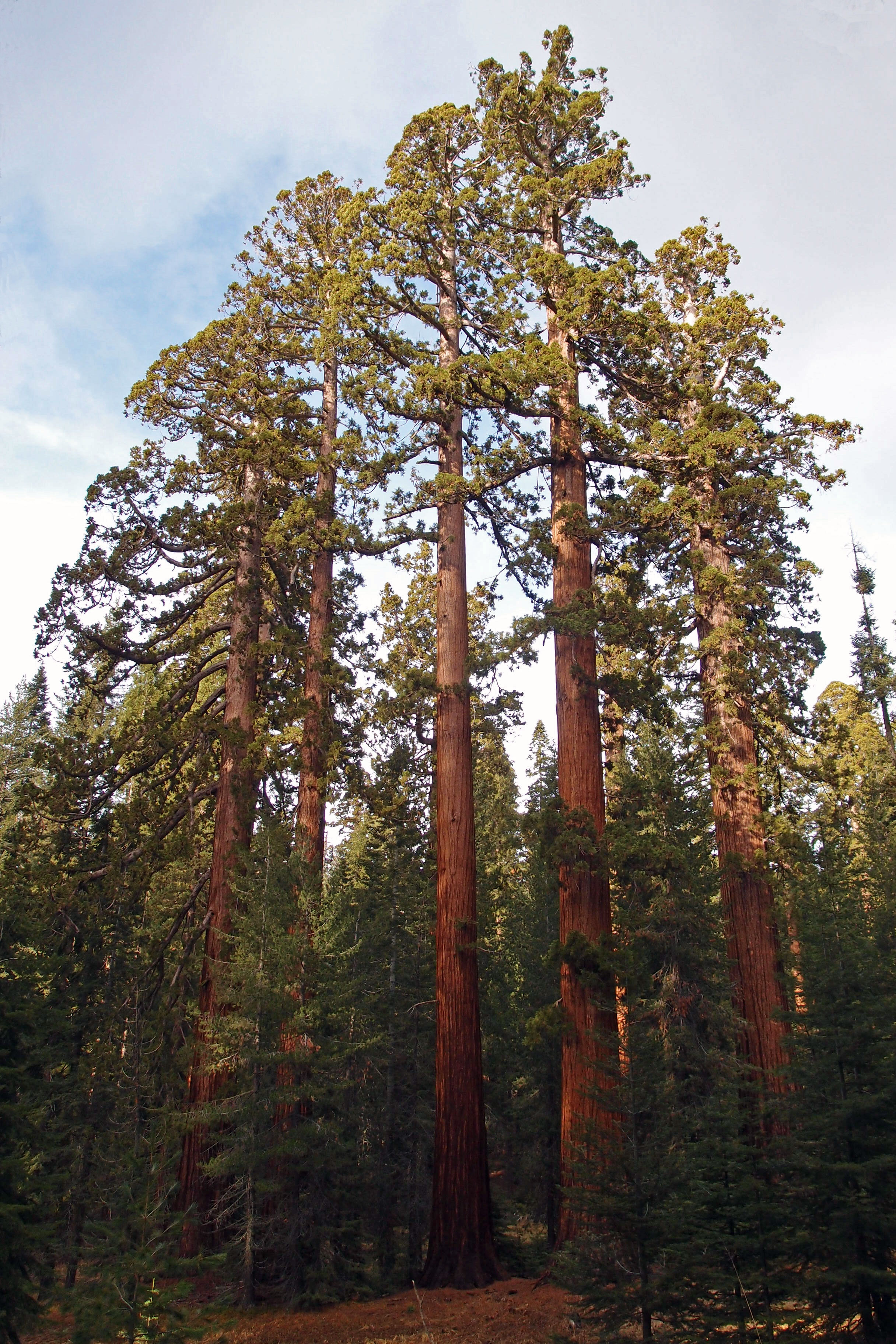
Giant Sequoia Trees in the Mariposa Grove of Giant Sequoias
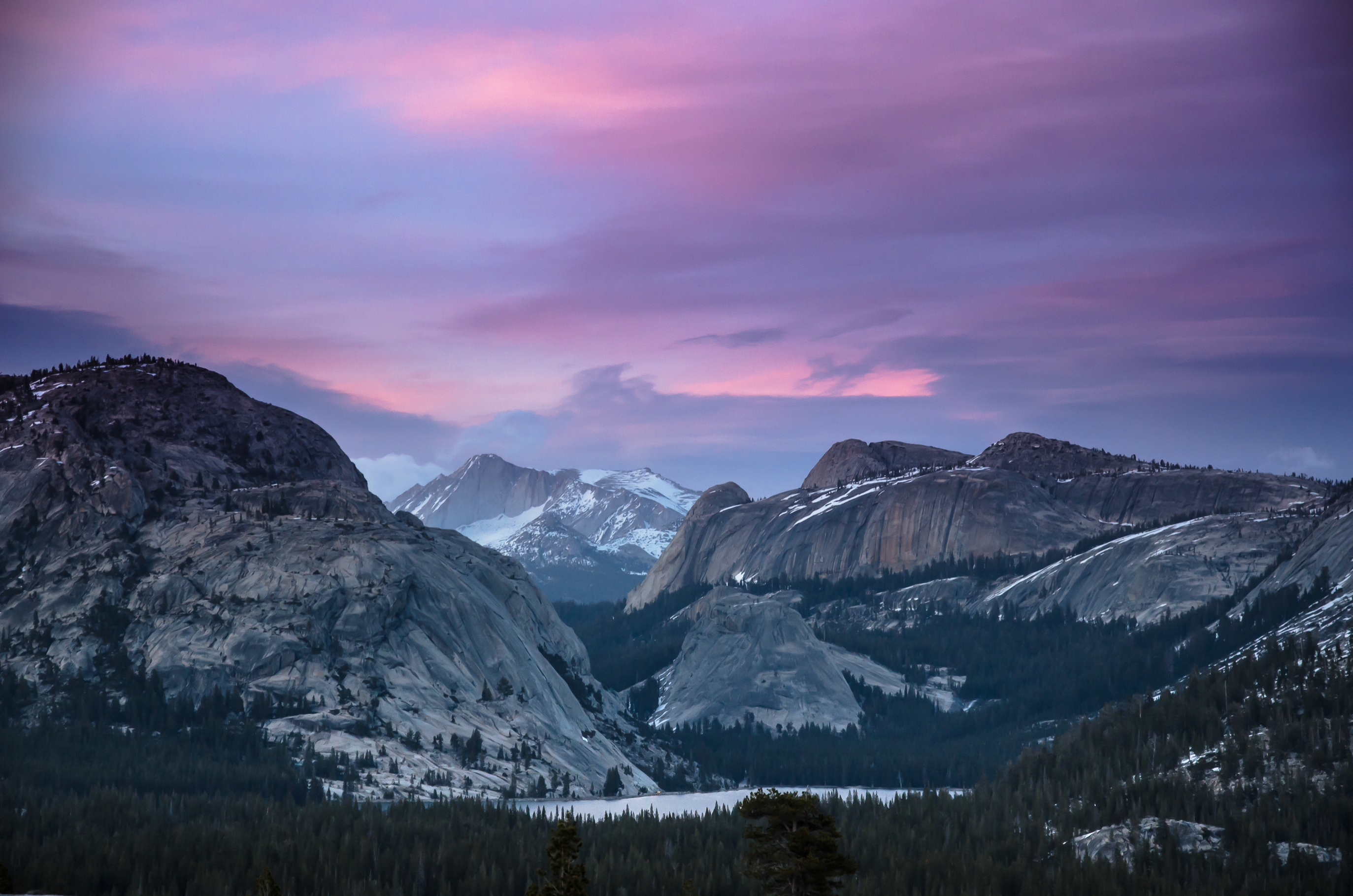
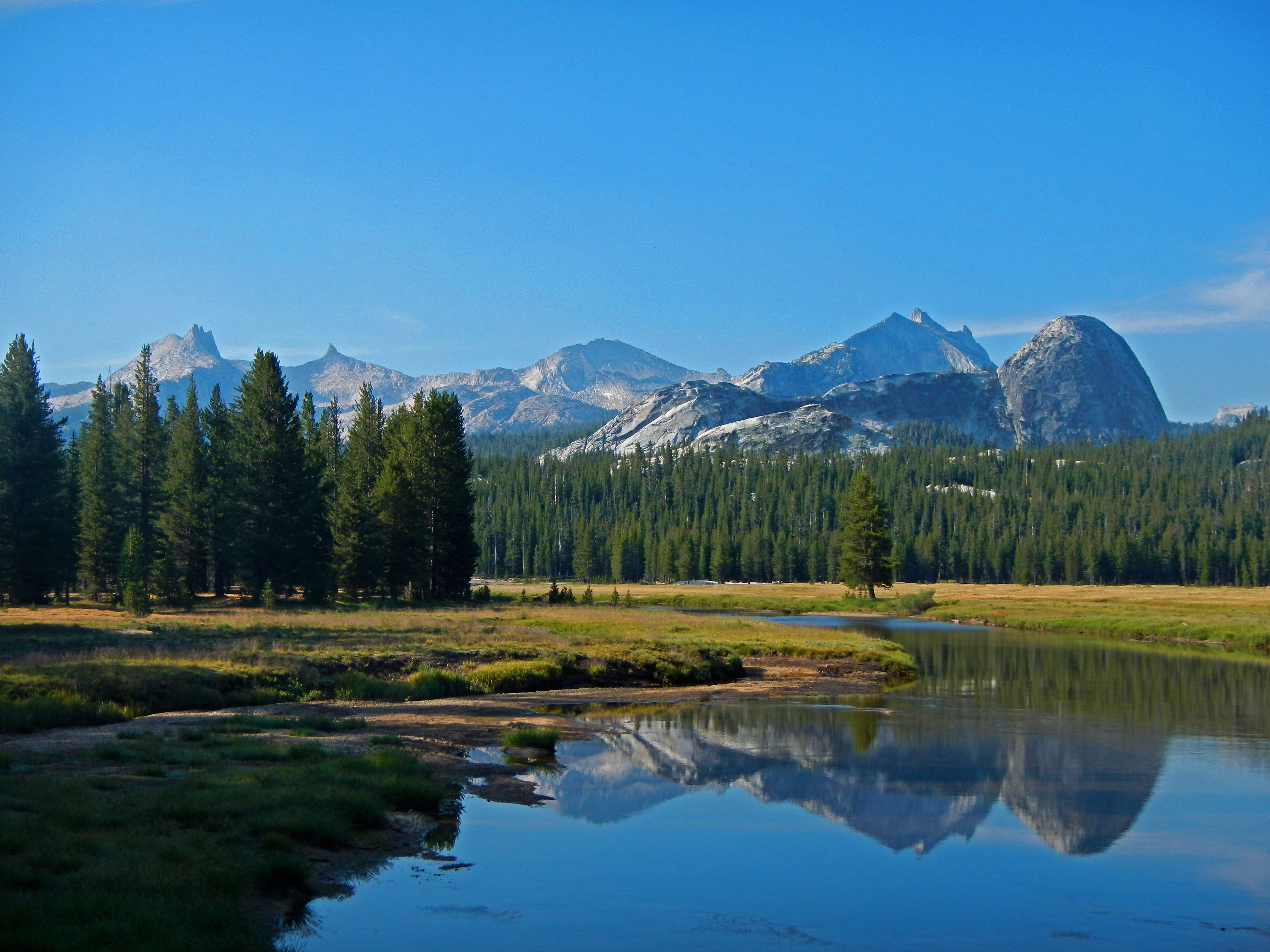
Tenaya Lake at Sunset
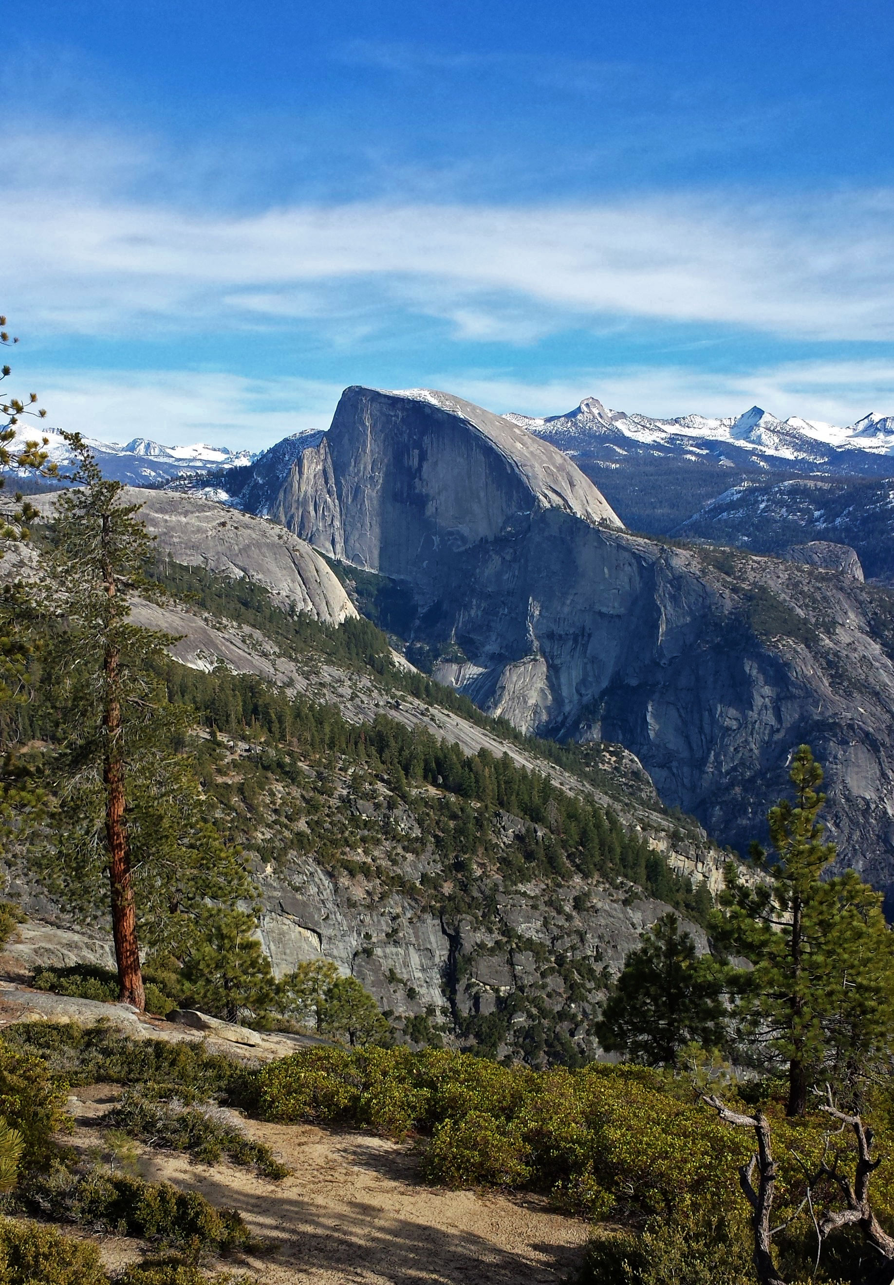
Half Dome
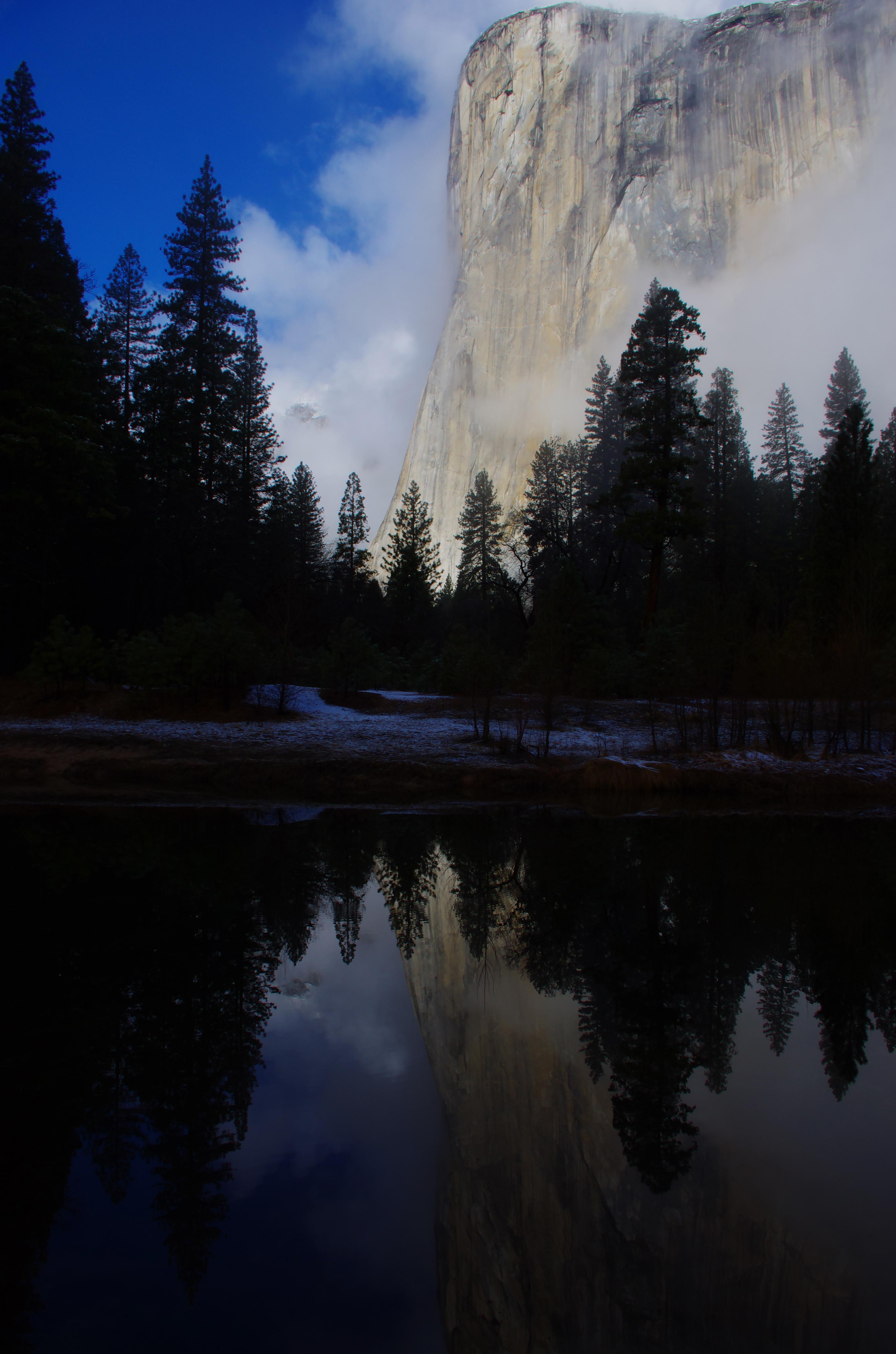
El Capitan
View of Yosemite Valley in Winter
Alerts
Weather forecast
Air Quality
To-Do Activities
- Arts and Culture
- Auto and ATV
- Scenic Driving
- Astronomy
- Biking
- Boating
- Camping
- Backcountry Camping
- Climbing
- Fishing
- Food
- Guided Tours
- Hands-On
- Hiking
- Backcountry Hiking
- Horse Trekking
- Horseback Riding
- Ice Skating
- Living History
- Paddling
- Junior Ranger Program
- Tubing
- Snow Tubing
- Skiing
- Snow Play
- Snowshoeing
- Swimming
- Wildlife Watching
- Birdwatching
- Park Film
- Museum Exhibits
- Shopping
- Bookstore and Park Store
Things to explore
Sorry, Not have any trail or things you can explore
Campgrounds and More
The Bridalveil Creek Campground is located along the Glacier Point Road near Bridalveil Creek and is surrounded by a beautiful forest of red fir and lodgepole pine. At an elevation of 7,200 feet (2,200m) the campground is located 7 miles west of Glacier Point, 9 miles east of the Wawona Road turnoff, and is approximately 45 minutes from Yosemite Valley. The spectacular views from Glacier Point are nearby, and numerous hiking trails are located along the Glacier Point Road. There are no services nearby.
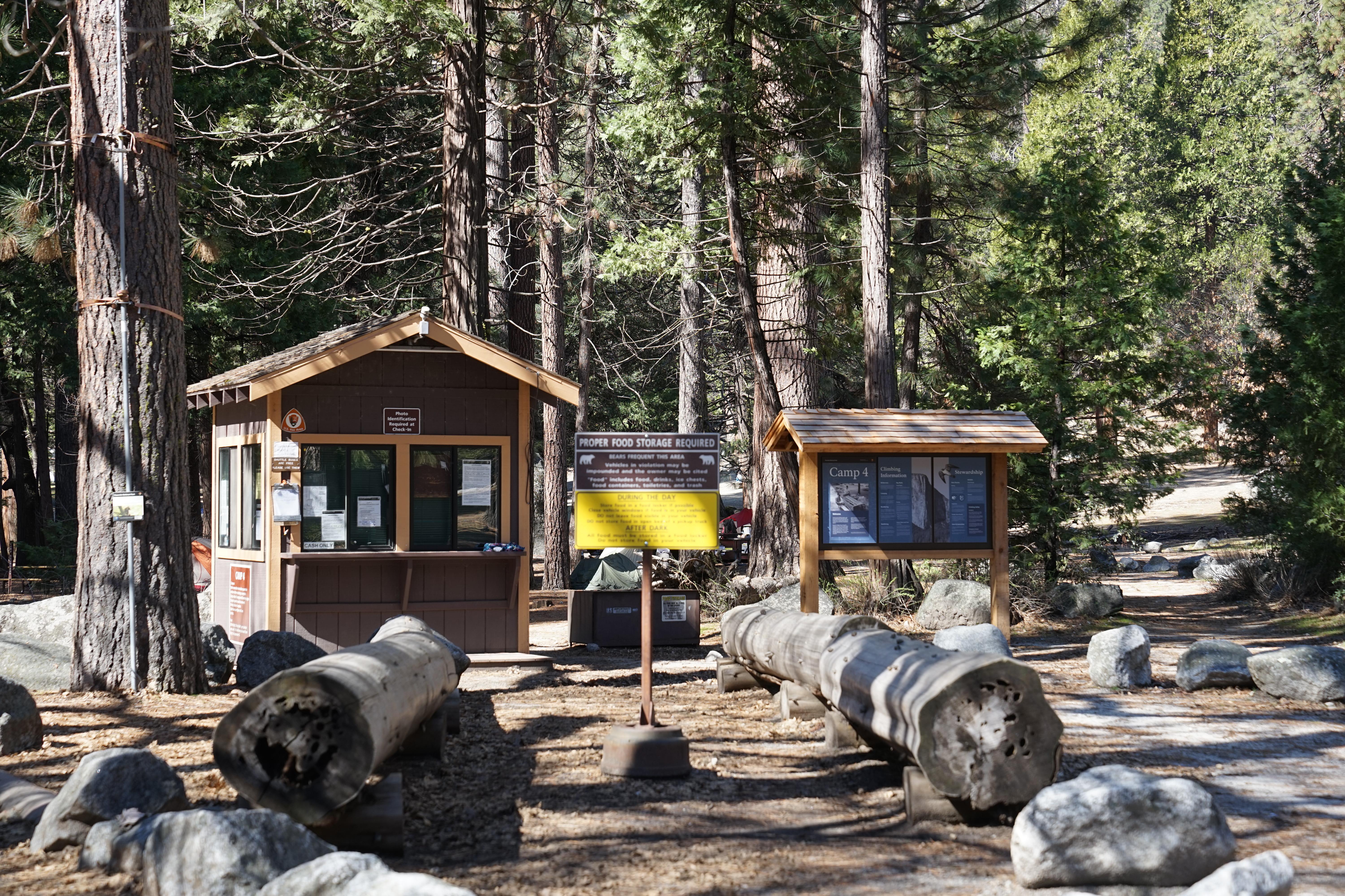
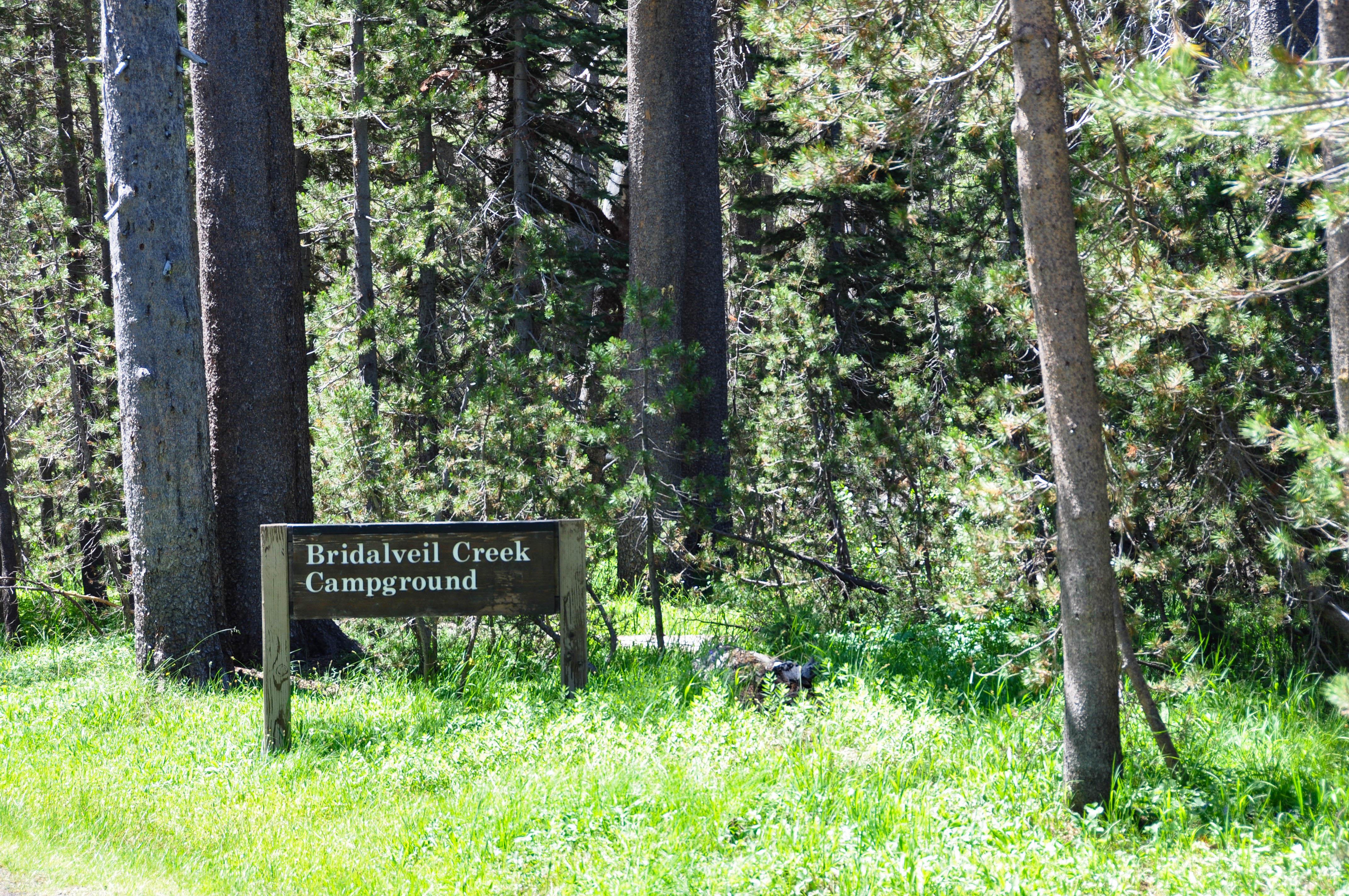
Camp 4 is located in Yosemite Valley near the base of granite cliffs close to Yosemite Falls. Yosemite Valley is centrally located in the park and boasts some of Yosemite’s most iconic features. This campground is located at 4,000 feet (1,200 m) elevation and can be accessed from all park roads. Camp 4 is within biking and walking distance of many services in Yosemite Valley and is located near the free shuttle route. There are food and grocery services nearby at Yosemite Valley Lodge and Yosemite Village.
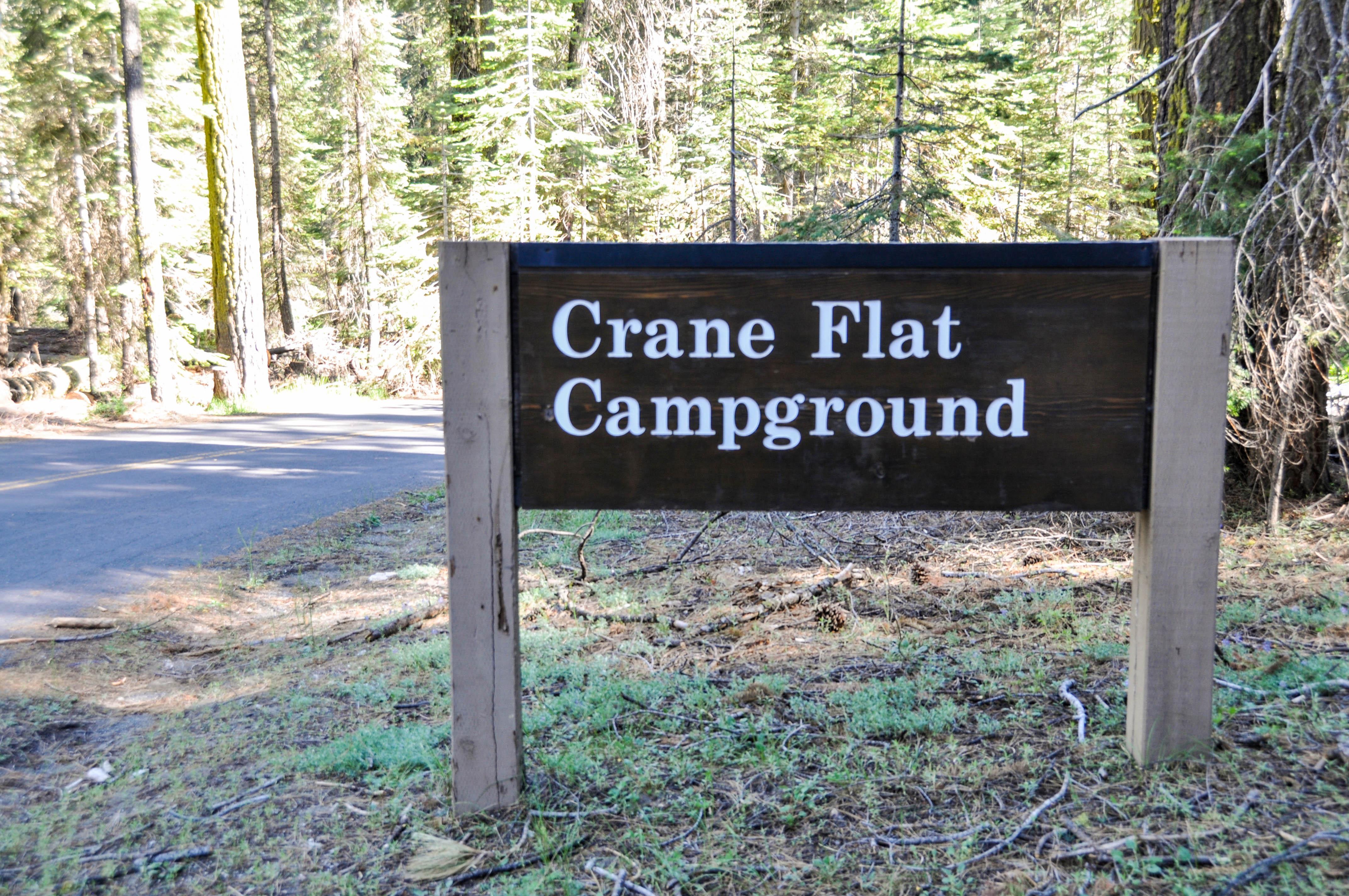
The Crane Flat Campground is located along the Big Oak Flat Road, just west of Crane Flat, about 30 minutes northwest of Yosemite Valley, at 6,200 ft (1,900 m) elevation. There is a gas station and minimal convenience items located nearby at Crane Flat. Trailheads for both the Merced Grove and Tuolumne Grove of Giant Sequoias are located within a short drive of the campground.
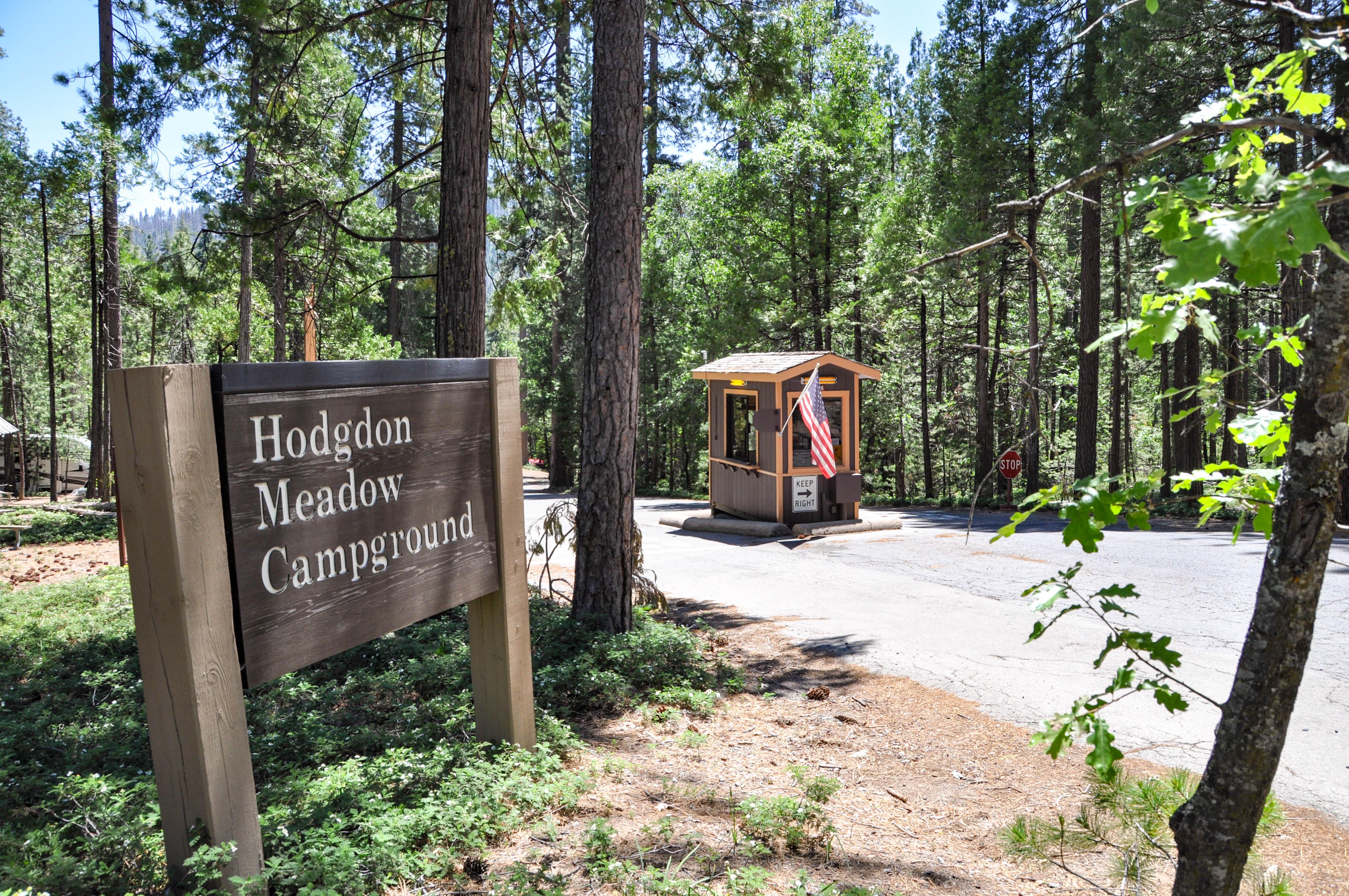
Hodgdon Meadow Campground is conveniently located along the Big Oak Flat Road at the Big Oak Flat Entrance. At an elevation of 4,900 feet (1,219 m), the campground is located along the western edge of the park, 25 miles and approximately 45 minutes from Yosemite Valley. There is a gas station and minimal convenience items located nearby at Crane Flat. Trailheads for both the Merced Grove and Tuolumne Grove of Giant Sequoias are located within a short drive of the campground.
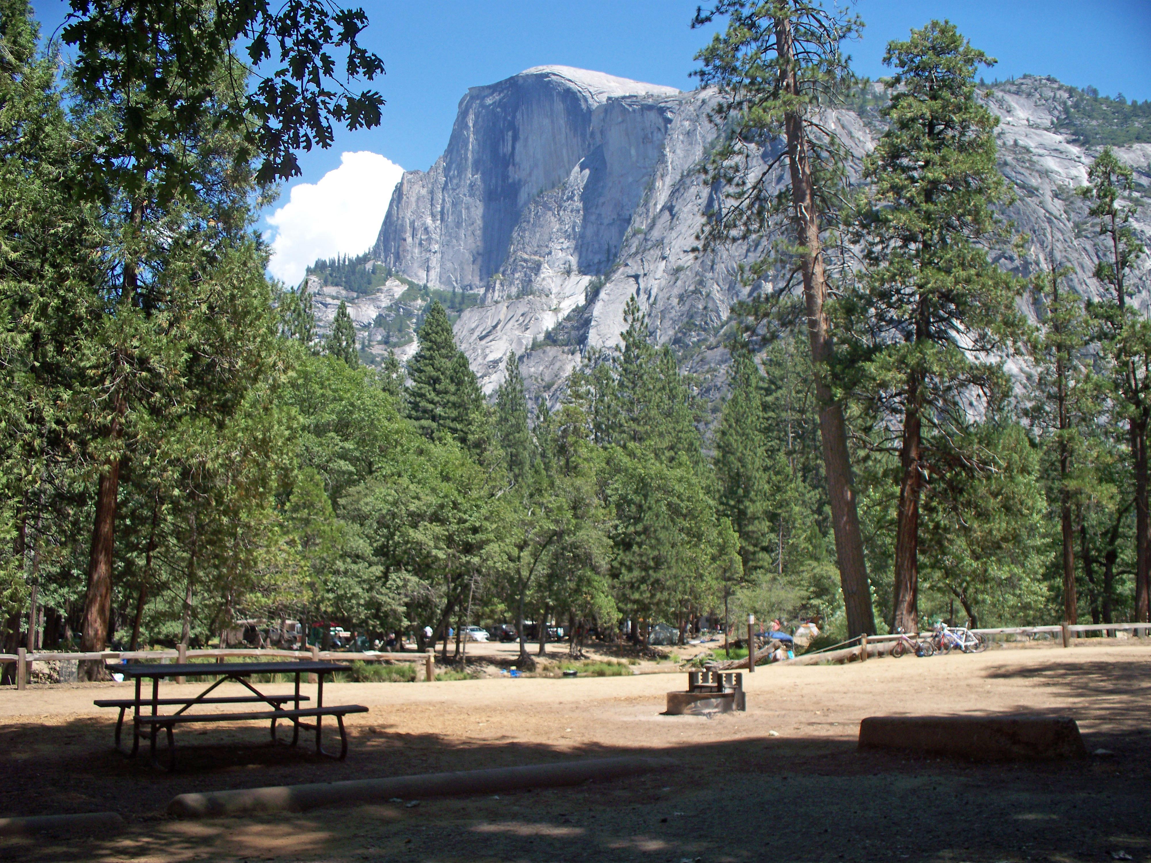
Lower Pines is located along the Merced River in Yosemite Valley. Yosemite Valley is centrally located in the park and boasts some of Yosemite’s most iconic features. This campground is located at 4,000 feet (1,219 m) elevation and can be accessed from all park roads. Lower Pines is within biking and walking distance of many services and trailheads in Yosemite Valley and is located on the free shuttle route. There are food and grocery services nearby at Curry Village and Yosemite Village.
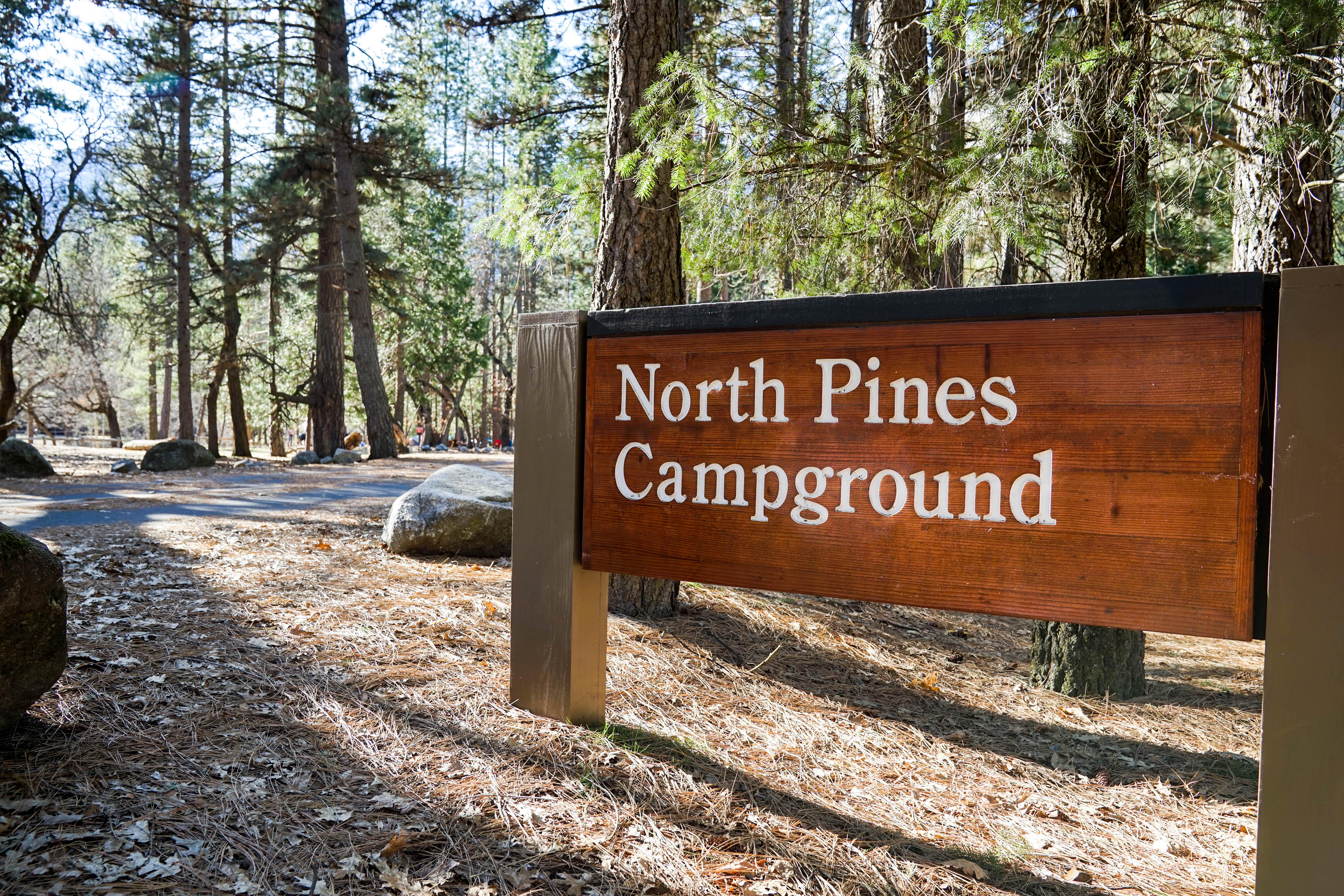
North Pines is located along the Merced River in Yosemite Valley. Yosemite Valley is centrally located in the park and boasts some of Yosemite’s most iconic features. This campground is located at 4,000 feet (1,219 m) elevation and can be accessed from all park roads. North Pines is within biking and walking distance of many services and trailheads in Yosemite Valley and is located on the free shuttle route. There are food and grocery services nearby at Curry Village and Yosemite Village.
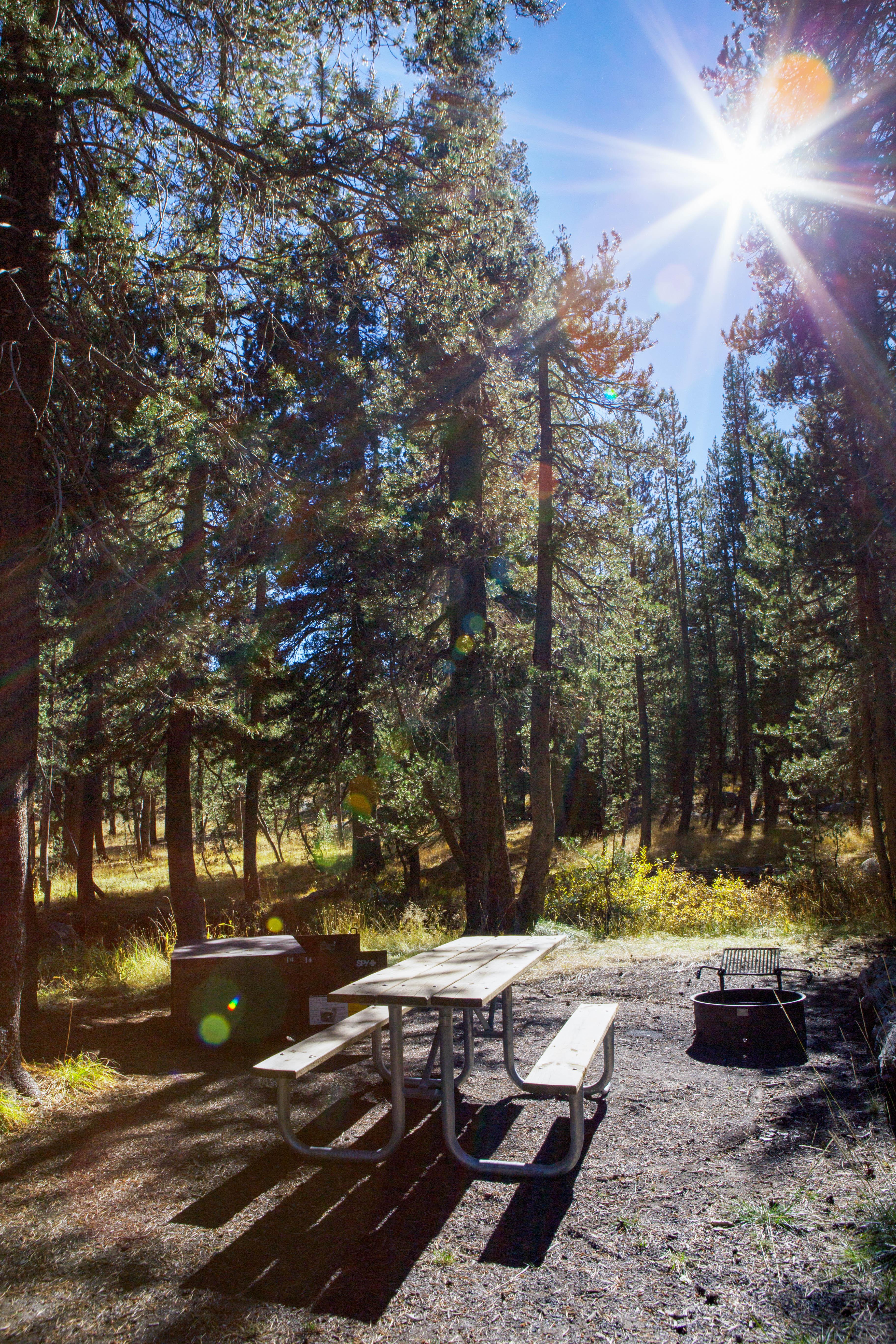
Porcupine Flat Campground is located off the Tioga Road about 30 minutes west of Tuolumne Meadows and over an hour from Yosemite Valley. RVs and Trailers are not recommended for the narrow roads in this more primitive campground. At an elevation of 8,100 feet (2,500 m) elevation, the campground is near Porcupine Creek, which is the only water source (must be filtered, treated, or boiled). The Porcupine Creek Trailhead is nearby. There are no visitor services close to the campground.
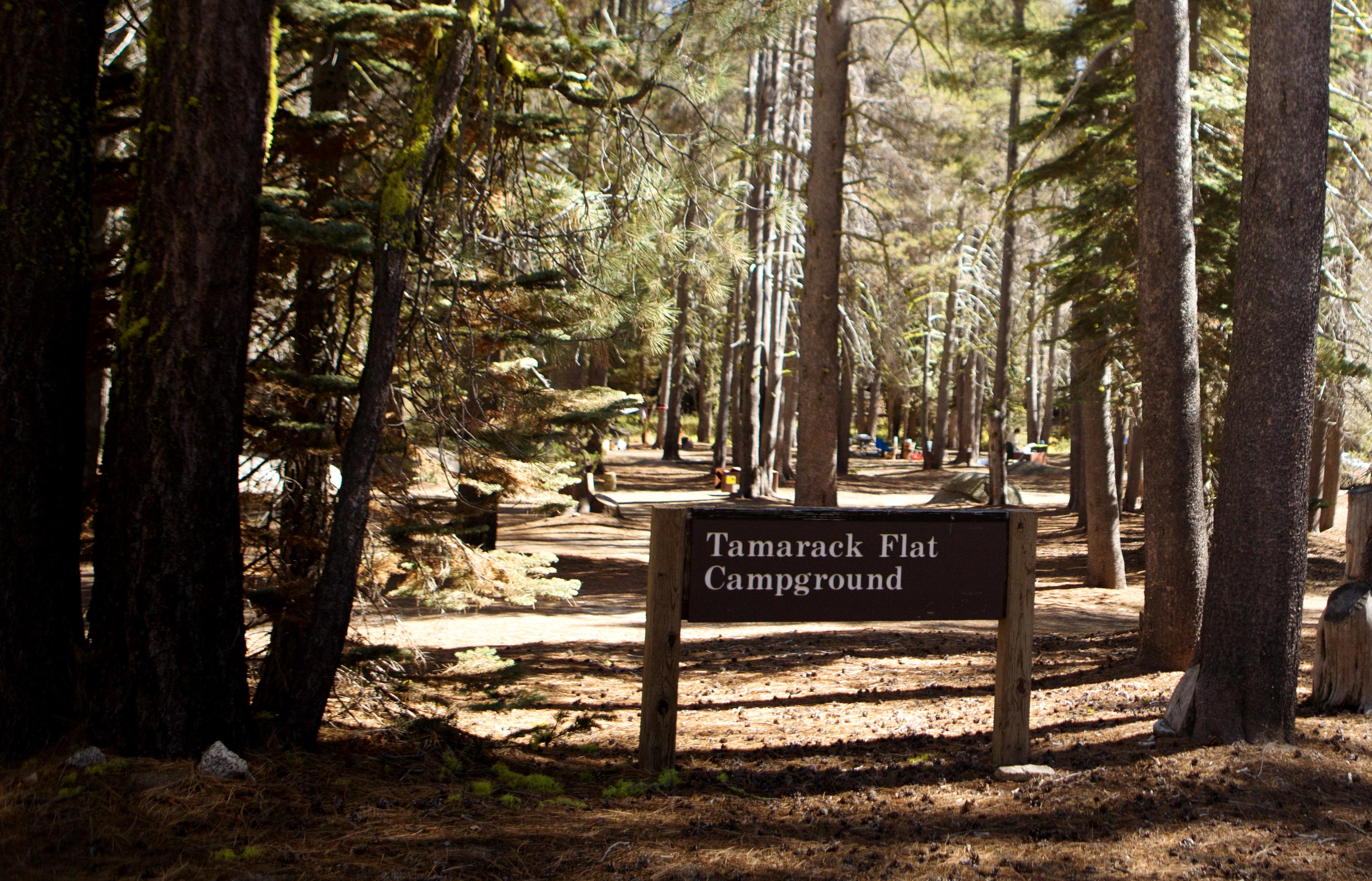
Tamarack Flat Campground is located off the Tioga Road just east of Crane Flat. The campground is approximately 20 miles (45 minutes) from Yosemite Valley and is tucked away in the forest 3 miles off Tioga Road. RVs and Trailers are not recommended for this harder to access, and more primitive campground. At an elevation of 6,300 feet (1,900 m) elevation, the campground is near Tamarack Creek, which is the only water source (must be filtered, treated, or boiled). There is a gas station nearby at Crane Flat.
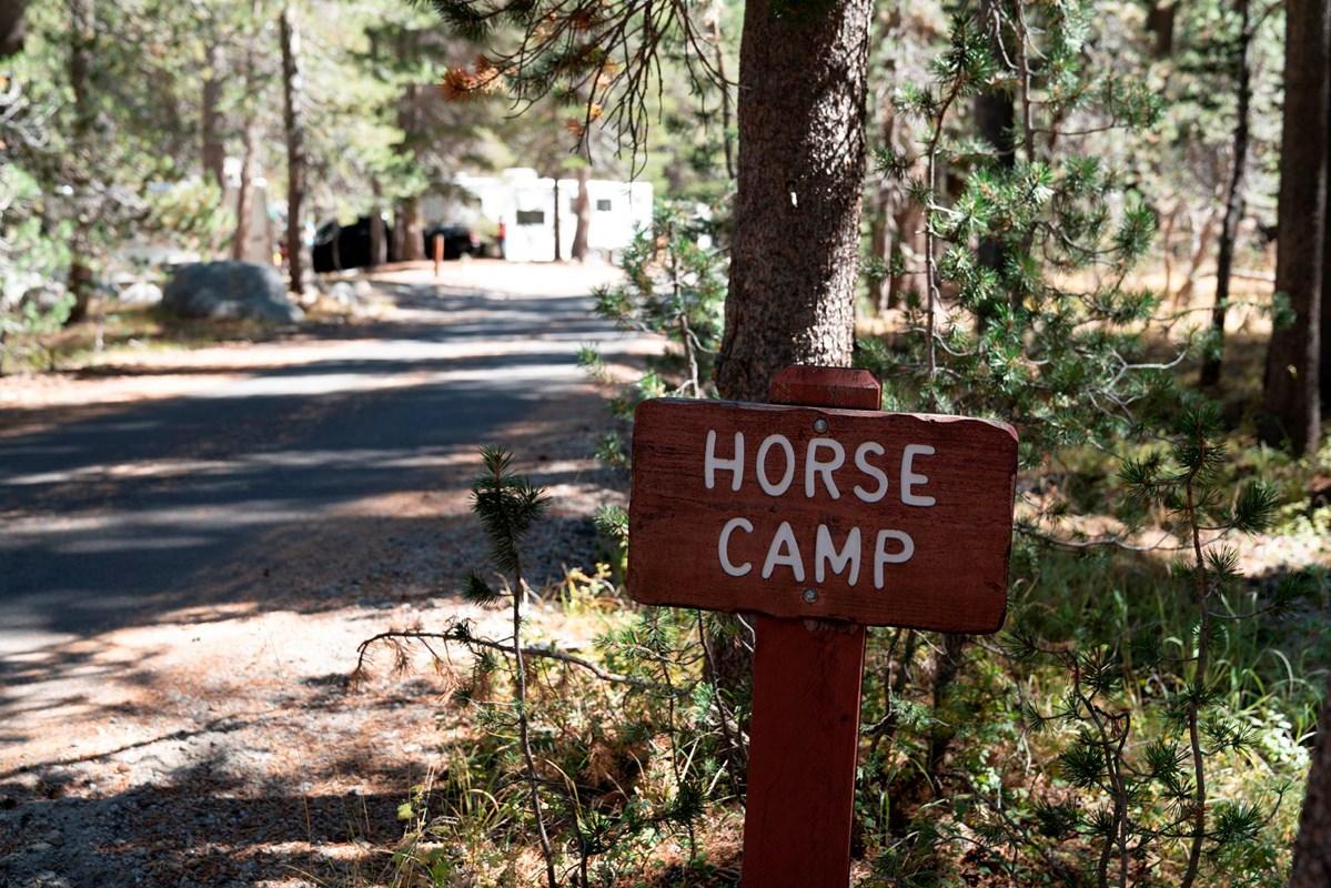
Tuolumne Meadows Horse Campsites are located within Tuolumne Meadows Campground in breathtaking Yosemite National Park in Central California's rugged Sierra Nevada Mountain Range at an elevation of 8,600 feet. The site is situated along the scenic Tioga Road just eight miles from the Tioga Pass Entrance Station and 55 miles from Yosemite Valley. Within Yosemite, visitors can gaze upon waterfalls, sheer granite cliffs, deep valleys, grand meadows, ancient giant sequoias, vast wilderness areas, and so much mo
Tuolumne Meadows Campground is Yosemite’s largest, and is located along the Tioga Road, with some areas located close to the Tuolumne River. At 8,000 feet (2,600 m) this campground is open seasonally and has wonderful summer access to many hikes, lakes, and prominent viewpoints. The campground is located approximately 1 hour and 30 minutes from Yosemite Valley but a small store, grill, and post office are located nearby in Tuolumne Meadows.
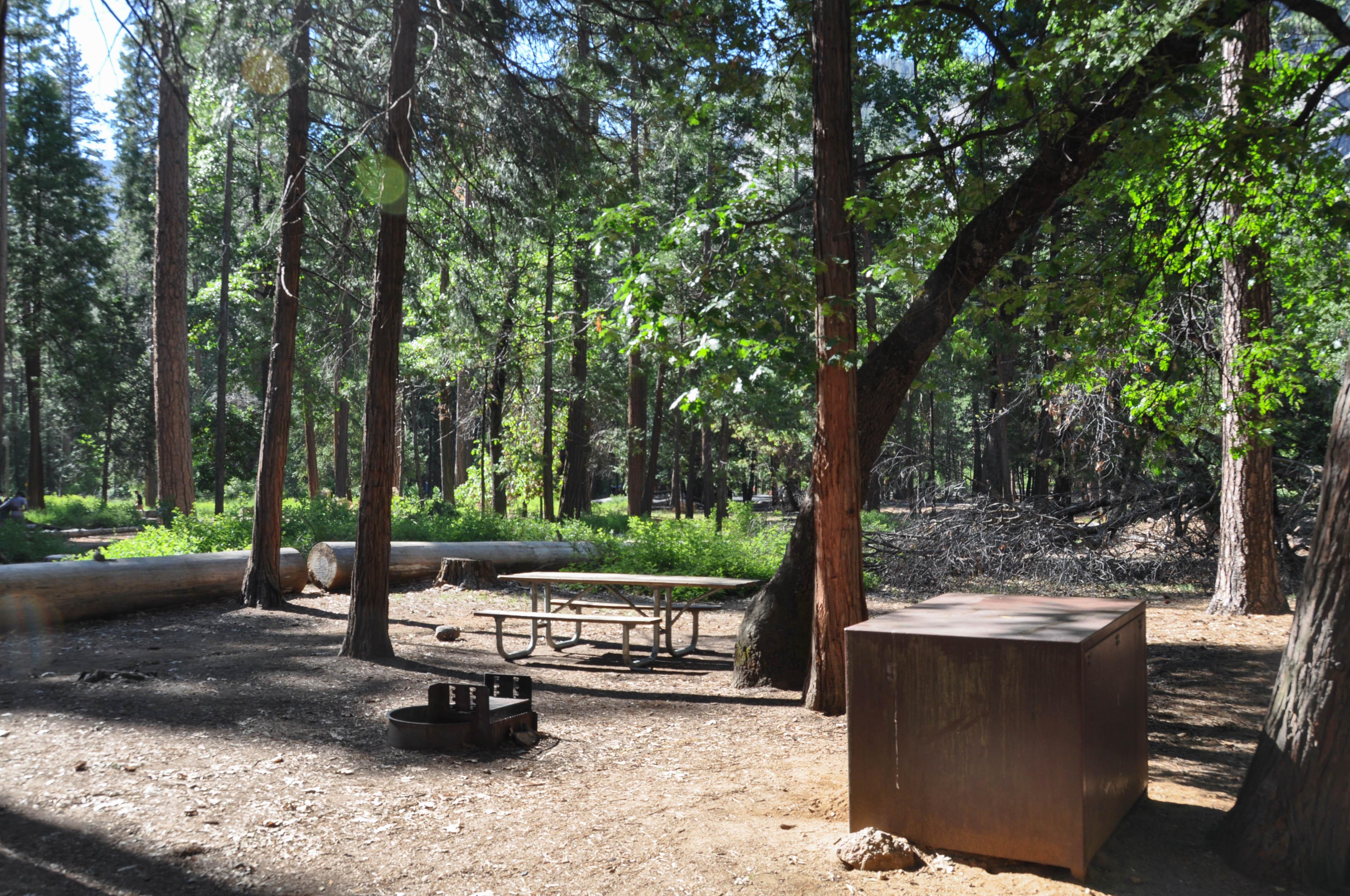
Upper Pines is located near the Merced River in Yosemite Valley. Yosemite Valley is centrally located in the park and boasts some of Yosemite’s most iconic features. This large campground is located at 4,000 feet (1,219 m) elevation and can be accessed from all park roads. Upper Pines is within biking and walking distance of many services and trailheads in Yosemite Valley and is located on the free shuttle route. There are food and grocery services nearby at Curry Village and Yosemite Village.
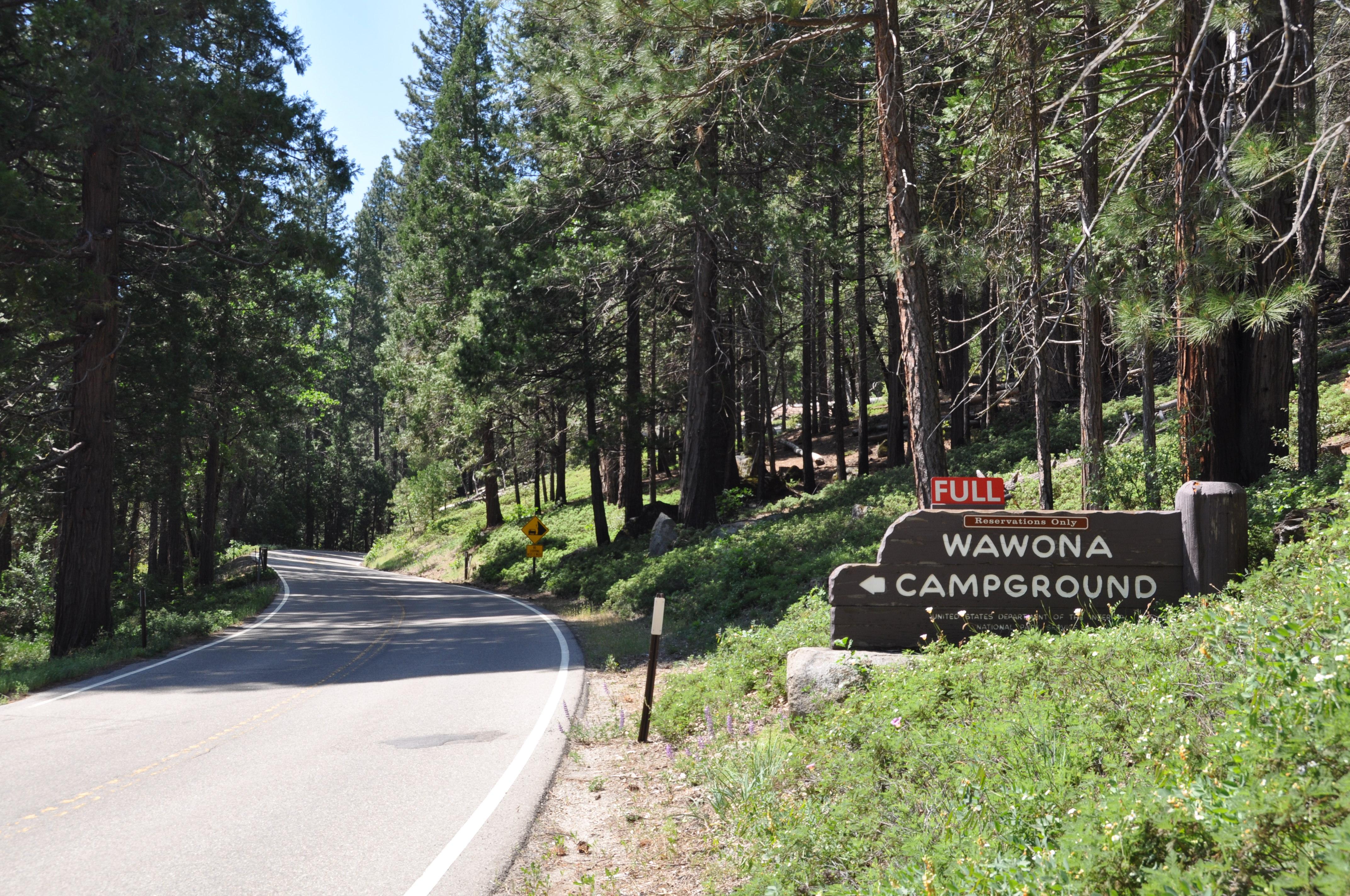
The Wawona Campground is located along the South Fork Merced River close to historic Wawona. At an elevation of 4,000 feet (1,219 m), the campground is located in the southern end of the park, 27 miles and approximately 45 minutes from Yosemite Valley. The majestic Mariposa Grove of Giant Sequoias is just a short drive away and the Yosemite History Center is in nearby Wawona where you can see some of the park’s oldest structures. Wawona offers a visitor center, hotel, and a market.
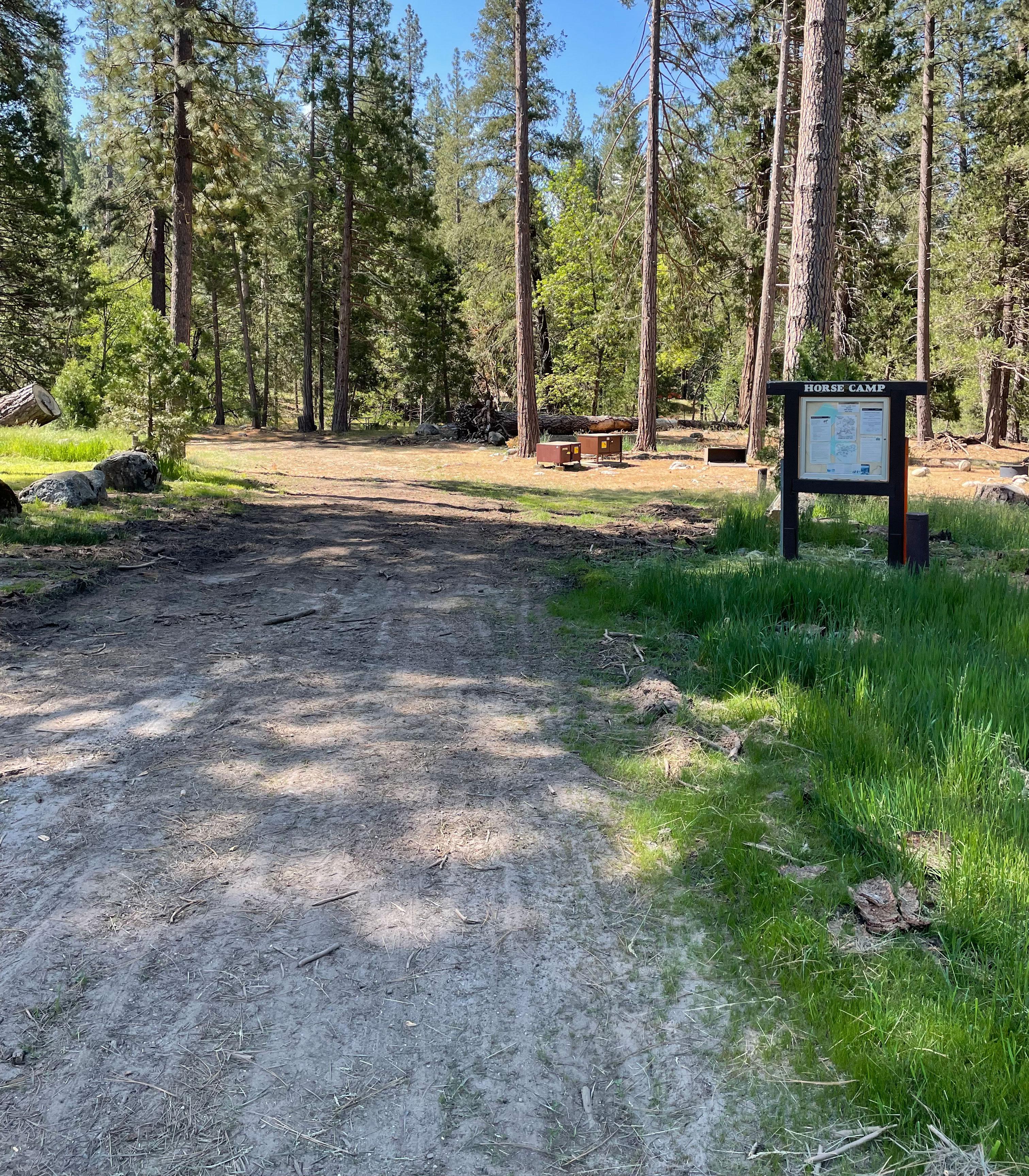
The Wawona Horse Camp is located along the South Fork Merced River adjacent to historic Wawona. At an elevation of 4,000 feet (1,219 m), the camp is located in the southern end of the park, 27 miles and approximately 45 minutes from Yosemite Valley. The majestic Mariposa Grove of Giant Sequoias is just a short drive away and the Yosemite History Center is right next door where you can see some of the park’s oldest structures. Wawona offers a visitor center, hotel, and a market.
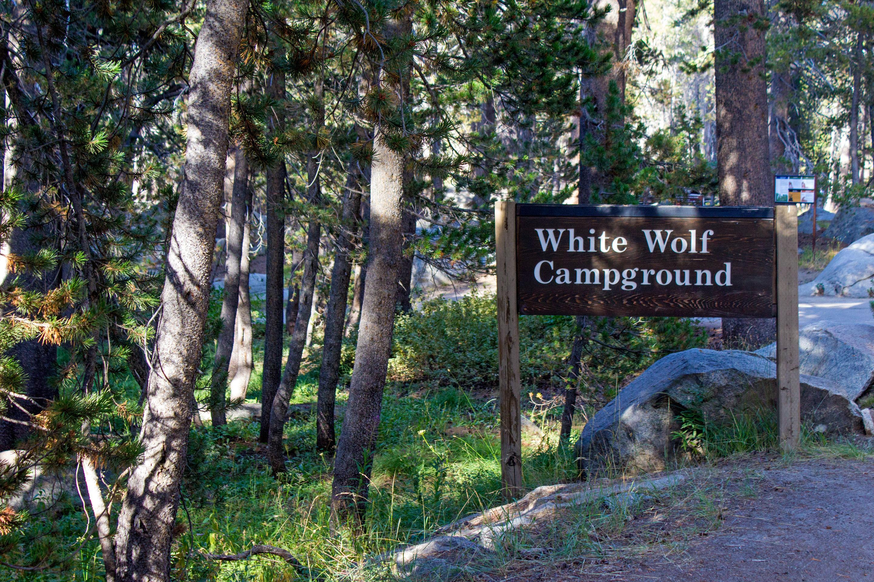
White Wolf Campground is located off the Tioga Road between Tuolumne Meadows and Crane Flat, approximately an hour from Yosemite Valley at 8,000 feet (2,400 m). The campground is tucked into the forest about a mile from Tioga Road near White Wolf Lodge. Trailheads nearby lead to Lukens and Harden Lakes and the area is popular for those accessing other wilderness destinations. Minimal services may be available at White Wolf Lodge (if open). There are no other visitor services close to the campground.
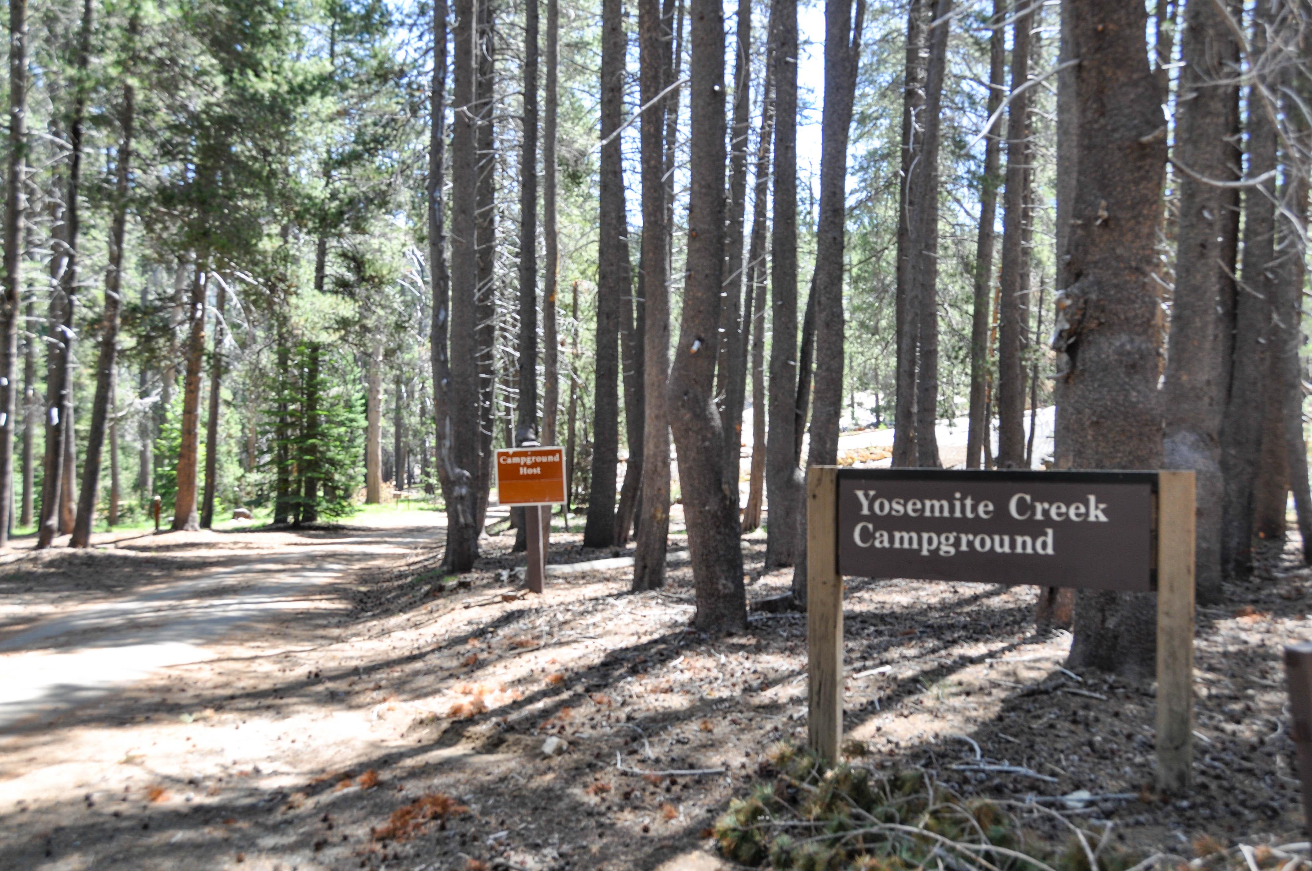
Yosemite Creek Campground is located nearly 5 miles off the Tioga Road (via a rough road) 26 miles west of Tuolumne Meadows, and a little over an hour from Yosemite Valley. Located in the forest at 7,700 feet (2,300 m) many campsites are close to Yosemite Creek, which is the only water source (must be filtered, treated, or boiled). RVs and Trailers are not recommended for this harder to access, and more primitive campground. There are no visitor services close to the campground.
Standard Park Information
Standard Opening Information: Hetch Hetchy area is only open from sunrise to sunset (except for permitted backpackers). All day visitors must exit Hetch Hetchy by sunset. The road is also closed to all vehicles (including backpackers) from sunset to sunrise.
Park Directions Information: You can drive to Yosemite year-round and enter via Highways 41, 140, and 120 from the west. Tioga Pass Entrance (via Highway 120 from the east) is closed from approximately November through late May or June. Hetch Hetchy is open all year but may close intermittently due to snow. Please note that GPS units do not always provide accurate directions to or within Yosemite.
Directions URL
Our Operating Hours
Weather Specific Information
Yosemite National Park covers nearly 1,200 square miles (3,100 square km) in the Sierra Nevada, with elevations ranging from about 2,000 feet (600 m) to 13,000 ft (4,000 m). Yosemite receives 95% of its precipitation between October and May (and over 75% between November and March). Most of Yosemite is blanketed in snow from about November through May. (Yosemite Valley can be rainy or snowy in any given winter storm.)